With the history of Kirkby dating back to before the Doomsday Book, there are many maps
Google Earth Pro
Recent imagery can be seen using the ‘historical imagery’ feature of Google Earth Pro. This currently displays imagery from late 2000 to the present day.
Maps at the National Library of Scotland
The National Library of Scotland has made a large number of maps that are out of copyright available through their website.
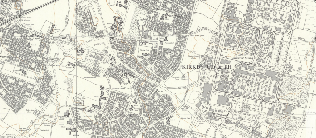
Ordnance Survey 1:10,000 map series:
Ordnance Survey 1:20,000 map series:
- 33/39 – outline and administrative boundaries – published 1946
- 34/40 – outline and administrative boundaries – published 1946
- 33/49 – outline and administrative boundaries – published 1946
- SJ39 (33/39) – colour, outline, administrative boundaries – published 1953
- SD40 (34/40) – colour and outline – published 1953
- SJ49 (33/49) – colour, outline and administrative boundaries – published 1953
Ordnance Survey ‘1-inch’ map series:
- Wigan (sheet 84) – outline, with hills – published 1896
- Liverpool (sheet 100) – published 1947 (does not include ROF Kirkby site)
- Liverpool (sheet 100) – published 1961
Ordnance Survey ‘6-inch’ map series:
- Lancashire XCIX and C – surveyed 1845-47
- Lancashire XCIX.NE, XCIX.SE, C.NW and C.SW – surveyed 1889-92
- Lancashire XCIX.NE, XCIX.SE, C.NW and C.SW – revised 1906/07
- Lancashire XCIX.NE, XCIX.SE, C.NW and C.SW – revised 1925
- Lancashire C.SW – revised 1937
- Lancashire XCIX.NE and C.SW – revised 1938
- Lancashire XCIX.SE and C.SW – revised 1939
Ordnance Survey ’25-inch’ map series:
- Lancashire XCIX.4, XCIX.8, C.9, C.13, C.6, C.10, C.14 – surveyed 1890/91/92
- Lancashire XCIX.4, XCIX.8, XCIX.12, XCIX.16, C.1, C.5, C.9, C.13, C.6, C.10, C.14 – revised 1906/07
- Lancashire XCIX.4, XCIX.8, XCIX.12, XCIX.16, C.1, C.5, C.9, C.13, C.6, C.10, C.14 – revised 1925
- Lancashire XCIX.4, XCIX.8, XCIX.12, C.13, C.10, C.14 – revised 1937/39